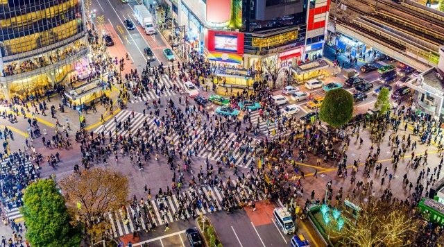
Following the earthquake that struck the Noto Peninsula on January 1st, there has been an increase in disaster preparedness awareness among Japanese residents. While there is abundant disaster preparedness information available, particular attention should be paid to the risk of earthquakes in residential areas.
Take Tokyo, for instance, which recently released its "Area Seismic Risk Measurement Survey," measuring risks such as building collapse and fire spread by area. This survey, now in its 9th iteration, covers 5,192 neighborhoods within the Tokyo metropolitan area. It categorizes them into three types: "Building Collapse Risk," "Fire Risk," and "Overall Risk."
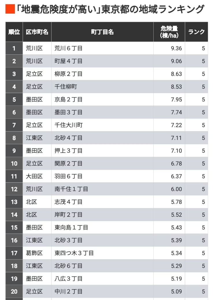
Based on the results of the "Comprehensive Risk Level" survey, here are the top 100 "Tokyo Seismic High-Risk Areas" (for detailed information, please refer to Tokyo's "Area Hazard Level" page).
■ Assessment of High-Risk Areas
Unlike the "Estimation of Direct Earthquake Losses to Tokyo from the Capital Region," which assumes specific earthquakes, the seismic area risk measurement survey does not. Conducted approximately every five years since 1975 (with the latest version released in September 2022), this survey compares disaster risks between areas by simulating earthquakes of equal intensity across all towns.
Professor Kazuki Nakabayashi, Honorary Professor at the University of Tokyo and Chairman of the Tokyo Metropolitan Area Risk Measurement Research Committee, explains, "The severity of ground shaking varies depending on whether it occurs in urban centers or suburbs. Earthquake losses are calculated based on the number of buildings destroyed, the frequency of fires, and the extent of fire spread in each town, allowing for relative comparative assessments. However, densely forested urban areas face the highest risks due to concentrated damage."
The "Overall Risk Level" of the survey results combines building collapse risk and fire risk, taking into account the convenience of evacuation, firefighting, and rescue operations. The risk levels are categorized using a five-level relative evaluation. The proportions for each level are predetermined, with towns ranked starting from the highest-risk level.
At the highest risk level (Level 5) is 85 Dindinmoku (1.6%), followed by 288 Dindinmoku (5.6%) at Level 4, 822 Machidinmoku (15.8%) at Level 3, 1653 Machidinmoku (31.8%) at Level 2, and the top-ranked area being 2344 Machidinmoku (45.2%).
The top-ranked overall risk areas are "Arakawa 6-chome in Arakawa Ward," followed by "Machiya 4-chome in Arakawa Ward," and "Yanagiwara 2-chome in Adachi Ward."
■ Enhancing Earthquake Preparedness through Area Hazard Assessment
Professor Nakabayashi elucidated on utilizing the survey results. "Regional hazard maps are also available on the websites of the Tokyo Metropolitan Government and the wards/cities, so those searching for apartments or condos should check what kind of risks they might face if an earthquake were to strike the town they wish to reside in.
For those already living in high-risk towns, this provides material for considering their own disaster prevention measures, such as fire-resistant renovations and seismic retrofits. The Tokyo Metropolitan Government and various wards/cities also provide support for construction costs, hoping everyone will make thorough preparations."
Click to view the complete ranking of 100 "Seismic High-Risk Areas" within Tokyo Metropolis