Name: Minamidaitō Island (みなみだいとうじま)
Address: Minamidaitō Village, Shimajiri District, Okinawa Prefecture
Area: 30.57 km² / Circumference: 21.2 km / Elevation: 75.1 m
Population: 1,198
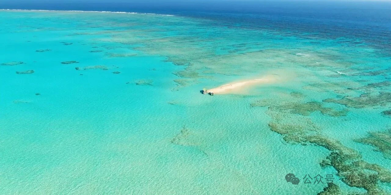
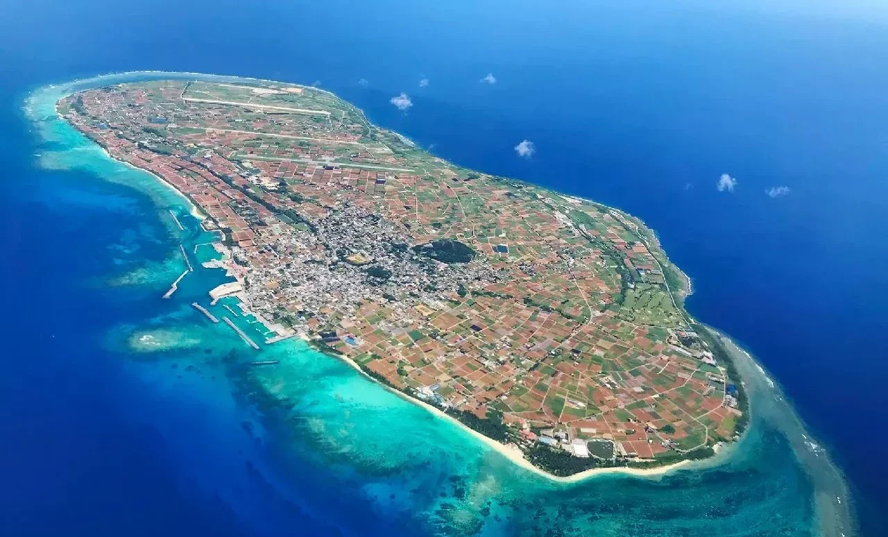
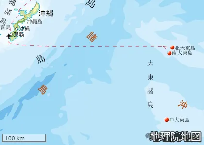
Rising from the depths of the Pacific Ocean, Minamidaito Island is located at 25°50'N, 131°14'E, about 340 kilometers east of the main island of Okinawa. Rising from the ocean floor some 4,000 meters deep, its pinnacle coral reefs rise repeatedly and form a rare raised atoll – one of only a handful worldwide – which is shared with its northern counterpart, Kitadaito.
This island, formed about fifty million years ago, has never been connected to the Asian continent or the Japanese archipelago. Today, sixty percent of its land is devoted to sugarcane, a testament to its singular geography and history, which have fostered a distinctive natural and cultural environment.
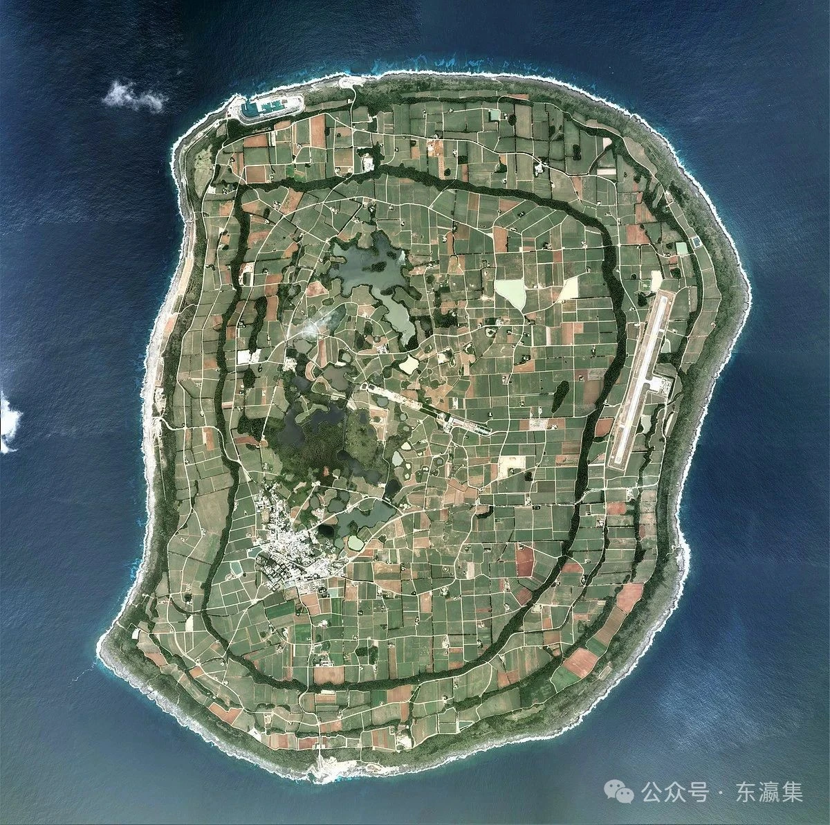
Surrounded by cliffs, the center of the island sinks into a basin. Just eight kilometers to the northeast is Kitadaito, while 150 kilometers to the south is uninhabited Okidaito. Together, these three islands comprise the Daitō Group within Okinawa Prefecture. Their isolation from the Ryukyu Arc and unique settlement history give the Minamidaito a subtly different environment from the other Okinawan islands.
Historical records suggest vague awareness of the island by the mid-17th century, although it was not clearly charted until the 19th century. Discovered by the Russian ship Borodino, European maps once named it "Borodino Island". Local people of the main island of Okinawa have long revered it as Ufuagari-shima – "Far Island of the East" – as a sacred site within the Nirai Kanai faith.
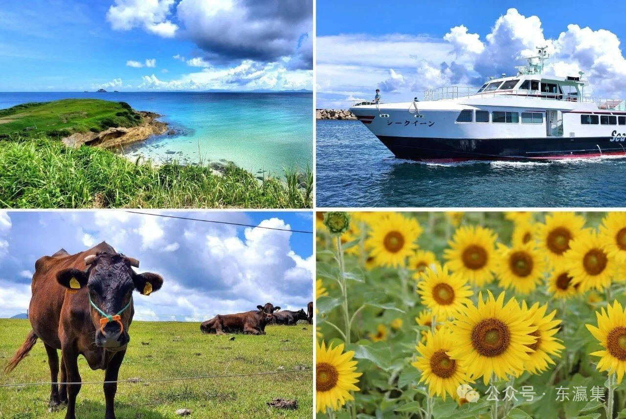
Residents of Hachijo Island and later immigrants from Okinawa created a culture combining Kantō and Ryukyuan traditions. Culinary treasures like Daito Soba, Daito Sushi, and Daito Yokan epitomize this fusion. Nature is also fantastic: the island harbors endemic species, including the Daito fruit bat (a nationally designated natural monument), the Daito dog, and the Daito scops owl.
On its northernmost pond, Oike, lies one of the world's rarest freshwater mangrove forests, protected as a National Natural Monument. Although lacking sandy beaches, the island's rocky coast plays host to the Navy Stick Pool and the Shioya Seawater Pool – simple carved basins where visitors can swim among fish and shrimp. These wonders earned a place among Japan's "100 Island Treasures", although they are closed during high tide or rough seas.
Access: 🚢 Ferries depart from Naha's Tomari port, with approximately fifteen-hour journeys, operating once to twice a week (approximately every five days).
Depending on wind and sea conditions, ships stop at Nishiko, Kitako, or Kameike ports.
✈️ Flights from Naha Airport take about an hour, with two daily services (some via Kitadaito).